
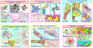
Worldwide detailed digital map list, at any time if required please ask our nearest representative or contact us directly for the maps required
How to work with Geobis Digital Maps and Socio Geo demographics in different solutions available for doing the work in different industries.
The standard technology known as Geographic Information Systems (GIS) is one of the biggest technologies available for browsing and using Geobis Digital Maps and Strategic Data, other important uses are based with Spatial Databases and Business Intelligence Solutions.
![]()
Map Engines and Industries Brochure
Different solutions available for doing the work in different industries.

Below there is a small description of the most important categories for your knowledge:
Indutries
» Banking
» Insurance
» Pharmaceutical
» Security
» Distribution
» Retailers
» Real Estate
» Telecommunications
» Health
» Advertising
» Epidemiology
» Engineering
» Marketing and Sales
» General Business
» Tourism
» Govermment
» Military Forces
» Cadastral
» Mapping and GIS companies
» Transport
» Worldwide Organizations
» Others please ask
Engines
» Geobis EZU
» Geobis GIS
» Geobis MapSimplicity
» Mapinfo
» Arcview
» Arcinfo
» MapXtreme
» ARC IMS
» Oracle
» Cognos
» Google
» Open GIS
» QGIS
» KGIS
» Idrisi
» Terra
» Autocad
» OpenMaps
» MapServer
» Qserver
» Others please ask
Vector Maps Formats
» Geobis
» KML
» Google Earth Pro
» Oracle Spatial
» Esri (SHP)
» Mapinfo (TAB)
» Postgres Spatial
» DXF (Autocad)
» DWG
» Garmin
» Others please ask
Video: The Art of Maps
Take a couple of minutes to see our new video about mapping. “The Art Of Maps”